")


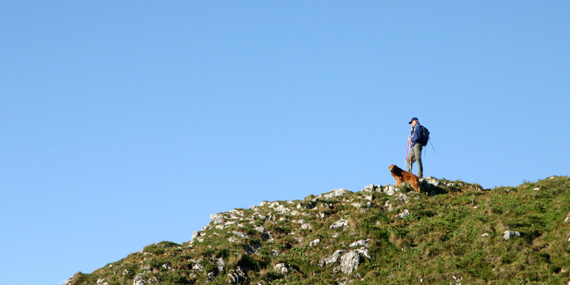
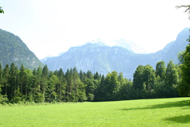
If you live in Munich, you have mountains and valleys, lush green meadows, torrential ravines, crystal- clear streams and blue swimming lakes virtually at your doorstep. And a slower pace and a return to nature are back in style precisely at a time of globalization and rapid advances. The nearly inexhaustible offerings and varied opportunities in Munich and its surroundings promise unadulterated relaxation and quality of life. Whether you set out by car, train, bicycle or rapid transit or whether you choose a cozy cabin, rocky peak, mystical pilgrimage site or relaxed beer garden as your destination, there is sure to be something for everyone! The hiking trails described here are suited to demanding day-long excursions for the athletes among us as well as family outings and easy hikes. You enjoy the fresh air and the invigorating exercise. And you revel in the feeling of accomplishment when you reach your destination and have a well-deserved, hearty snack along with a refreshing herb lemonade or a sweet, light beer. The entire experience lets you forget your daily cares and thoroughly enjoy life. And so lace up your hiking boots, pack your backpack and head up onto a mountain!
Tip: At www.planetoutdoor.de, you can simply enter your address and destination and then get directions. The site also features a tour “Quickfinder.”
Overview of hiking destinations
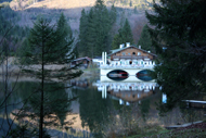
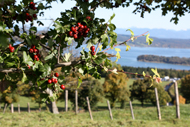
Ammersee
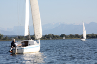
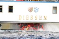
Route information: Shore length 42 km, easy; seaside towns: Herrsching (see below, small spa park castle), Dießen (St. Mary minster), Schondorf, Utting (Restaurant Alte Villa)
With a surface of 466 sq. km., Ammersee is the smaller but somewhat more idyllic sibling of Starnberg Lake, offering numerous beaches and opportunities to take boat trips. The promenade on the shore in Herrsching and a beer garden with the lovely view of the lake in Stegen are especially popular. The Gasteiger artist residence with its rambling Rodenhauser Park in Utting and the famous Andechs monastery with beer garden are also worth-seeing
›› Directions: Take the S-Bahn Line S8 line toward Herrsching to the end station of the same name (about 50 min.); by car, A96 toward Lindau to the Herrsching exits (about 50 min.)
›› Back
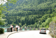
Berchtesgadener area
With mountains, cabins, alpine pasture, valleys and ravines, lakes, pilgrimage churches and a mining adventure park (www.salzwelt.de) – Berchtesgaden offers a tremendous variety of leisure options and numerous hiking trails. Here are a few select routes.
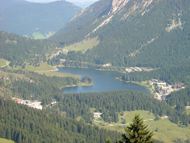
Schönau am Königsee 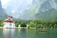
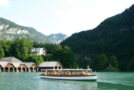
The emerald-green, romantic Königsee (www.koenigssee.com), lies surrounded by high mountains (Watzmann, 2713 m) in the Berchtesgaden National Park. Numerous electric boots bring crowds of tourist straight across the lake to the St. Bartholomä peninsula and back. One of the high points of the boat trip is the impressive multiple echo that a few notes on a flugelhorn demonstrate to guests. You can hike through endless, soft meadows and on craggy climbs or ride in a gondola at the Jenner adventure mountain (1874 m), for example.
Grünstein
Route information: Starting point Schönau, 4.5 hrs., 9.7 km, medium, 771 m high
Proceed through the forest from the parking area at Hammerstiel farm and sign post No. 445 until you reach the Grünstein hut. The trail takes you up to the summit of Grünstein mountain (a cross is at the summit). The descent again passes the hut and then left toward Königsee or left at Hofreit, continuing along the foot of the mountain back to the parking area.
›› Directions: take the regional train through Freilassing to Berchtesgaden, and then by RVO bus line to the Kramerlehen bus stop; by car, take B305 to Engedey (Bischofswiesen) via Duftberg to the Hammerstiel farm
Gotzenalm
Route information: Starting point Schönau, 5-6 hrs., 10.1 km, medium-difficult, 995 m high, the alpine meadow also can also be reached from the middle station of the Jenner cableway
Starting from the Hintenbrand parking area, the route proceeds to the Königsbach alpine pasture and rises steeply to the Priesberg pastures. There the hiking trail climbs slightly until the entrance to the “bull moats,” and then the “lower deer run” branches off toward Gotzenalm. The path is shady and can be slippery in wet weather. From the rundown Seeau pasture, you stay on the route until you reach Gotzenalm. From Feuerpalven – which you reach from the pasture in about 15 min., you can enjoy a lovely view of Königsee, the east wall of Watzmann mountain, and St. Bartholomä.
›› Directions: take the hourly regional train (toward Salzburg) , which runs through Freilassing to Berchtesgaden, and then take RVO Bus 9541 to Königssee; by car, take A8 to the Piding exit, and then B20 through Bad Reichenhall and Berchtesgaden to Königssee
Kärlingerhaus
Route information: a total of 7 ½ hrs., the trip by boat to St. Bartholomä 1/2 hour there and back, 3/4 hour from Sallet to Königsee, medium, almost all the tours in the area pass through Kärlingerhaus (popular with visitors)
From the boat anchorage in St. Bartholomä, left on the marked trail along the shore as far as the rocks of the Burgstall face and the Schrainbach wooden hut. After crossing a stream, the trail runs steeply upward through the forest to the rundown Unterlahneralm pasture and ascends out from the forest to the steep passage of the narrow Saugasse gully. There you find the high valley of the equally rundown Oberlahneralm pasture, from which you can hike through the so-called “stove door” upward to the Funtensee saddle. You hike on a slight decline to Kärlingerhaus on Funtensee.
The route heads back on the hut trail to just past the Funtensee saddle. Then go right along the marked trail down to the Grünsee, which you brush along its north side, then continue left through the woods until you arrive at Grünseetauern and the valley floor of the Sagereckalm pasture. Then proceed northward, ascending to the edge of the mountain. From there you descend steep rock steps equipped with safety ropes. Go right to reach Salletalm pasture on the south shore of the Königsee.br />›› Directions: Take the train through Freilassing and Bad Reichenhall to Berchtesgaden, from there the RVO bus to Königssee; by car, take the Salzburg autobahn to the Piding exit, then through Bad Reichenhall to Berchtesgaden and then on to Königsee
Through the Almbach gorge to Ettenberg
Route information: 7.1 km, 3 hrs., medium
The starting point is the still operational pebble mill where marble is ground. The climb through the 2.5-km, wild, romantic gorge affords an impressive view of deep pools and a wild mountain torrent with a waterfall, until the gorge widens into a valley. Here you can visit the baroque Ettenberg pilgrimage church and find refreshment at the inn next-door.
A steep trail takes you back. If you are in the mood, you can take another route back and visit one of Berchtesgaden’s most beautiful churches, the Maria Gern pilgrimage church.
›› Directions: take the train to Freilassing or Salzburg, and then travel by bus toward Berchtesgaden to the Almbachklamm-Marktschellenberg bus stop (2-3 hrs.); by car, take Deutsche Alpenstraße B305 toward Marktschellenberg until you reach the Almbachklamm (gorge) turn-off and the Almbachklamm parking area between Marktschellenberg and Berchtesgaden
Wimbach valley and Wimbach gorge
Route information: 8.3 km, 5 hrs., Wimbachklamm (gorge) 200 m long, easy
You begin negotiating the gorge at the valley entrance and ascend a moderately steep incline to Wimbachgries hut (1,327 m), where you can take a break and enjoy some refreshment. Along the way, you pass Wimbach castle (closed for renovation in 2011). Access to Wimbach gorge is only possible at the start of the gorge, not when you head back from Wimbach castle (bypass).
›› Directions: take the train to the Berchtesgaden main train station, and then an RVO bus to the starting point, the Wimbach bridge; by car, the Salzburg autobahn to the Piding/Bad Reichenhall exit, and then toward Berchtesgaden, then right toward Ramsau where B20 meets B305 until you reach the Wimbach bridge to the left of the federal highway; www.ramsau.de
›› Back
Blomberg
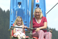

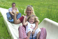
This family friendly mountain is located in the Bavarian alpine upland with a view of Starnberg Lake, the Ammersee and the Isar Valley. You also get to enjoy a lovely panorama of the Alps from Karwendel to the Wetterstein mountains. Its easy hiking trails have good signage and pass through thick mountain forests and green meadows. In dry weather, the coasting slide is open to young and old from 9 a.m. to 4 p.m. (www.blombergbahn.de)
›› Directions: take the BOB to the Bad Tölz train station and then RVO buses 9612/9591/9610 to the Blomberg cableway bus stop; by car, take A8 toward Salzburg, exiting at Holzkirchen, and then B13 toward Bad Tölz; or Munich A95 toward Garmisch-Partenkirchen, exiting at Sindelsdorf, then B472 toward Bad Tölz; or B11 toward Innsbruck and toward Bad Tölz once past Penzberg
›› Back
Brauneck
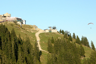
The Brauneck (1,555 m high), between Loisach and Isar, is one of the most beautiful excursion destinations in the Bavarian alpine uplands and features many hiking trails. There are also many mountain inns offering wonderful views. And if you are looking for more than hiking, it offers ideal conditions for such trendy sports as climbing (200 routes) or paragliding and hang-gliding. The cable railway runs daily from 8:20 a.m. to 5 p.m.
›› Directions: take the BOB, which runs hourly to Lenggries, then take RVO buses to the valley station of the Brauneck cable railway; by car, take A8 toward Salzburg/Nürnberg and head toward Tegernsee/Bad Wiessee/Bad Tölz , exiting at Holzkirchen (No. 97), first of all on B318 and then on B13 to Lenggries and the parking area at the valley station for the cable railway. www.brauneck-bergbahn.de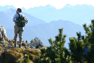

Kleiner Höhenweg
Route information: 30-60 min., 1,556 high, easy
The path leads from the mountain station (1,520 m) up to Brauneckhaus and beyond to the Brauneck summit cross. From there it heads west from the para-gliding and hang-gliding launch point, and then onto the steep track past Schrödlstein peak and then down to the Tölzer hut, where you can enjoy a hearty snack, and then back on the same trail for the return trip.
Reiseralm
Route information: 1 hr., 950 meters high, easy, suited to families
At the mountain station parking area, the circular route heads to the right, past the Streidlhang ski lift, and then it ascends a bit and passes through the forest to Reiseralm, where you can stop for a snack. One alternative for the descent is the forest path behind Reiseralm along the stream, which takes wide turns back to the parking area.
Almwanderung
Route information: 2 hrs., 1,520 meters high, easy
Beginn ist die The start is the mountain station. From there you go as far as the Almwanderung (alpine pasture hike) split-off just before the Tölzer hut. There it heads left to the Quenger pasture and then down to the left on the mountain road to the Bayernhütte inn. You go left once you are past it and take the small path to the left, which crosses alpine meadows and leads to Florianshütte inn. From there you can easily reach Kotsattel and ascend left through the woods back to the mountain station.
Längental
Route information: 4-5 hrs., medium, the path is designed for an ascent or descent combined with a cable railway trip
After you arrive at the mountain station by cableway, you take Trail 5 as far as Gatterl and from there down to the Probstalm hut (which does not serve restaurant fare). From there the path goes further into Längental on a steep, romantic track below the Probst face all the way to the valley floor. First you arrive at the “Hinterem Längentalalm,” (which serves restaurant fare) and after the second pasture the “steep hunter’s path” leads to the right over the marsh and then through the forest and on woodland paths past the ski club seat lift, and finally down to the valley station of the Brauneck cableway.
›› Back
Garmisch-Partenkirchen (Zugspitze)
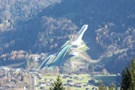
Garmisch-Partenkirchen, where the Olympic jumping takes place, draws skiers and snowboarders in the winter with its famous Zugspitze (3,000 meters), and you can take beautiful hikes here in the summer.
›› Directions: the regional train runs hourly to the Garmisch-Partenkirchen train station; by car, take A95, and then B2 to Garmisch-Partenkirchen
Eibsee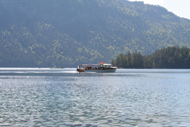

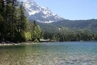
Route information: 1,000 meters high, about 7 km, 2 hrs., easy
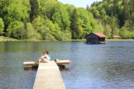
Due to its location, the lake is quite cold for swimming, but you can enjoy always some refreshment after a round-trip on the hiking trails or on a Eibsee excursion in a rowboat or “reserl” (motorboat). You start at the parking area in front of the Eibsee Hotel and go as far as the bridge at Untersee and then continue westward, parallel to Waxenstein gorge. The path goes uphill and then downhill at times, and into the forest and back again to the lake. The final station is the Eibsee pavilion, where coffee and cakes beckon.
›› Directions: Zugspitz cableway or Eibsee bus, which leaves from St. Sebastian Church in Partenkirchen and arrives at bus stops in Garmisch-Partenkirchen, Grainau and Hammbersbach; by car, from Garmisch-Partenkirchen through Grainau and Eibsee mountain to the valley station of the Zugspitz cableway to the Eibsee Hotel (numerous parking spots)
Garmisch adventure trail
Route information: 3 km, about 1 hr., 18 stations, easy
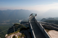
The path (www.zugspitze.de), framed by the wonderful backdrop of the Wetterstein mountain range, takes you on a well-built hiking trail from the mountain station of the Alpspitz cableway to the mountain station of the Kreuzeck cableway and is thus perfect for children and adults. An experience for all the senses with lovingly elaborated stopping points. The AlpspiX viewing platform awaits you right at the start of the trail, offering a breath- taking panoramic view.
Partnachklamm
length of gorge 700 m, open summers: 8 a.m.-6 p.m. Winter: 9 a.m.-5 p.m.
From the parking area for the ski stadium (Olympic jumping), the sign-posted, tarred trail leads to the entrance of the gorge. Admission is 3 euros (half-price for children) for individuals and 2 euros a person for groups of 15 and up. Rain-proof clothing is recommended, since water drips from walls and overhangs. Once you have explored the impressive gorge, you follow the posted paths to one of various huts and have a hearty snack. Hanneslabauer and Forsthaus Graseck are reached the most quickly, followed by Wettersteinalm and Partnachalm and the most distant, Hintergraseck.
›› Directions: take the regional railway to Garmisch- Partenkirchen, and then local buses to the ski stadium; by car, A95 toward Garmisch-Partenkirchen and then B2 toward Mittenwald and branch off to the right (Wildenauerstraße) toward the ski stadium at the end of the village
›› Back
Hackensee, Kirchsee and Reutberg Monastery
Route information: 3 hrs., 16 km, medium
From the parking area, the trail ascends to the Reutberg monastery, where you can stop for a bite to eat the at the monastery brewery. About 200 m to the north, a road branches off to the left to Kirchsee, about 1 km away. You either stay right there to swim or hike further to the more remote and less populated, marshy Hackensee. To reach the lake, you turn left at the wooden pay booth onto a forest path (the signpost says Dietramszell), which takes a small loop to the road. There you reach a steep access road to Kögelsberg a few meters north of a pond. You hike through the farmstead on an S-curve. You travel over open fields and through woods to arrive at Kirchseebach. You reach a road at the level of the Pelletsmühl farmstead, complete with water wheel, and then proceed on it uphill to the left. Shortly after reaching the forest zone, an inconspicuous path splits off to the right (a yellow sign warning of rabies is a good indicator for it). The trail becomes broader and leads into a T-shaped intersection. By turning left, you arrive at a small pond and marsh. A sign warns: “Enter at your own risk.” At yet another T- intersection, you stay to the left again and end up at Hackensee. You take the same path back.
›› Directions: Take S-Bahn Line 2 to Holzkirchen, then the RVO bus to Reutberg; by car, A8 toward Salzburg, exiting at Holzkirchen exit and taking B13 to Sachsenkamm, and then the split-off to Reutberg
›› Back
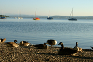
Herrsching
Aside from swimming, water sports and boating, you can take hikes through the Bavarian alpine uplands from this resort on the Ammersee. If you have already visited Andechs monastery, a famous pilgrimage site, you can acquaint yourself with two other lakes (Pilsensee and Wörthsee). If you have a choice, hike to Andechs during the week, since it is quite busy on weekends.
›› Directions: take S-Bahn Line 8 to Herrsching to the final station of the same name (about 50 min.); by car, A96 toward Lindau, take the Oberpfaffenhofen or Inning am Ammersee exit, on to Herrsching from there, parking area at the train station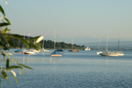
Pilsensee
Route information: 11.3 km, about 3 hrs., medium
The start is the Herrsching town center heading east. As soon as the footpath ends, the route turns right into Pilsenseestraße, which leads up uphill to the Widdersberg pond. The route moves past a camping area, from which you can take a side trip to Seefeld castle. A bridge leads into the castle, which has shops, a museum and brewery pub. At the end of the lake, you head left toward Inning. The path turns left again in Hechendorf, toward the Pilsensee swimming beach. Moving through the mansion district, you arrive in a cul-de-sac, at whose end you hike on a path along the railway line through the Herrsching bog. The route ultimately takes you back over a bridge to Herrsching.
Wörthsee
Route information: about 1 hr., medium
From the Herrsching S-Bahn station, cross the railway crossing away from the village until you reach Hechendorferstraße, then your route heads to the right onto Rauscherstraße to the hamlet of Rausch. From there you hike to Ellwang and end up at beautiful, popular Wörthsee, where you can swim and dine magnificently. You can also reach Wörthsee with S-Bahn Line 8 toward Herrsching (Steinebach stop)
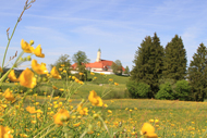
Andechs Monastery
Route information: a total of about 3 hrs., easy, www.andechs.de
The route takes you to the holy Andechs mountain and its no less famous Benedictine monastery, complete with brewery pub and beer garden. It starts at the S-Bahn station in Herrsching and moves through Kienbach Strasse, at whose end you turn right and then left again into Kiental Strasse, where you cross Mühlfelder Straße. The route continues to the right and into Abert Straße, which becomes Andechs Straße. You stroll by the steps to the church at your left and head into Kiental Strasse. The route passes the last houses and heads into the woods, through which you can hike on the main path. After you cross two bridges and pass a steep break in the mountain, the route takes a sharp left and heads uphill just before you reach a small house. Watch the signs! At the end, two fairly long stairways await you, and the trail ends in front of the monastery church.
›› Back
Herzogstand am Walchensee
Route information: 11 km, 1,730 m high, total of 4-5 hrs., medium, for the sure-footed and vertigo-free, www.herzogstandbahn.de
The starting point is the valley station for the Herzogstand cableway right at Walchensee. From there the route takes you in a serpentine route over the southwest slope of Fahrenberg mountain, with a lovely view of the Walchensee, Karwendel, the Wetterstein range and the Tirolean mountains, to the Herzogstand hut, where you can take some well-deserved refreshment in comfort. Then the route continues past Martinskopf peak (ca. 30 ,in.) through mountain pines to the Herzogstand’s summit cross and then on to the wooden pavilion at a somewhat higher elevation. To get back, you hike down the same route.
›› Directions: take the regional railway as far as Kochel am See (about 1 hr. 10 min.); by car, the A95 toward Garmisch- Partenkirchen, to the Murnau/Kochel exit, then continue to Kochel, then on B11 via Kesselberg to Walchensee (about 1 hr. 20 min.)
›› Back
Hirschberg

Route information: 3 1/2 hrs., easy, detour to Hirschberg mountain summit an extra 1 hr.
Hirschberghaus inn (Tel. 08029/465, Tuesdays off) lies 58 km from Munich on the 1,670-meter-high Hirschberg mountain in the Mangfall range near Tegernsee and Schliersee. At Scharling’s north end, the route heads west past the hamlet of Leiten to the high forest. There you ascend the mountain for an hour until a track splits off to the left. Then you take the wide farm road to the right, which climbs to Hirschlache (1,300 m). At the end of the track at the small lift house, it finally veers left in a steep serpentine route (about 1/2 hr.) to Hirschberghaus. After a bite to eat, you hike in a sweeping right- hand arc on open mountain pastures to the secondary summit and from there to the highest point. You follow the same route back to the valley.
›› Directions: Take the BOB (Bayerischen Oberlandbahn), to the Tegernsee train station, then buses 9550/9556 to Scharling (about 2 hrs.); by car, the autobahn toward Salzburg until you reach the Holzkirchen exit and take B318 through Gmund and Bad Wiessee to Scharling; the parking area is at the north end of the village, right at the starting point (about 1 hr.)
›› Back
Ilkahöhe
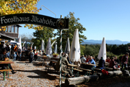
Route information: 728 meters, 10.8 km, 3 hrs., easy
The hike begins at the Tutzing train station, which initially follows the S-Bahn line. It continues in the narrow Waldschmidt gorge to Langer Pond, Lake Deixlfurt, Rüdiger Pond, Lake Clenze and Lake Johanna. From there, it is not far to Ilkahöhe. In clear weather, you have a lovely view of the Alps over Lake Starnberg. There is an inn below Ilkahöhe with a beautiful terrace and good food. Your return trip to Tutzing takes the same route.
›› Directions: take S-Bahn Line S6 to its final stop in Tutzing; by car on A95 to the Starnberg exit, turn toward the lake at the town center and proceed along the west shore of Lake Starnberg, and then through Niederpöcking, Possenhofen and Feldafing to Tutzing
›› Back
Kochelsee

Kochelsee Round Trip
Route information: 2-3 hrs., easy
The hike begins at the Kochel City Hall. You turn into Alte Straße, which ends at Schelmbichl. The route continues on a tarred footpath and then after a few meters proceeds to the left on a narrow forest path and then up to Lainbach. And then you walk over an iron bridge over a stream toward Altjoch, crossing the highway, and then through Altjoch to the Walchensee power plant. From here, the trail follows the pipeline bridge southward. Then you turn westward just before the Kochelsee shoreline and travel on a rock path along the shore. This romantic path along the south shore is not demanding and offers plenty of natural beauty. You continue through the meadows of Raut to Schlehdorf. You return to Kochel by bus or motorboat or on foot (45 min. on the state road on a bicycle/footpath).
›› Directions: take the regional railway through Tutzing to Kochel (about 1 hr.); by car, the A95 toward Garmisch-Partenkirchen, to the Murnau/Kochel exit, then about 9 km to Kochel am See
Jochberg
Route information: 1,565 meters high, 10.9 km, 3 1/2 hrs., medium
The route goes from the Kesselberg pass through mixed woodlands to the edge of the forest. There is a lovely view of Kochelsee, the Benediktbeuer Monastery and the Loisach Kochelsee marsh. The remainder of the route moves through open pasture to the Jochberg summit cross. On a clear day, you can see as far as Munich (across Stamberg Lake and Walchensee, Kochelsee, Staffelsee and Ammersee) from there. From Wendelstein mountain, you can take in the Achensee mountains, the Karwendel and Wetterstein ranges (including Zugspitze) as well as the Stubai Alps. As you descend the alpine pastures southward, you reach the Jocher-Alm in 20 minutes, whose hearty fare will revive you. (It servers hot fare from mid-May to the end of September, Mondays off). Then the trail heads eastward over the alpine meadow and up to Kotalm (which doesn’t serve restaurant fare) and then via a forest road and path back to Kochel am See.
›› Directions: take the regional railway Kochel, then the public bus toward Garmisch to the Kesselberg pass; by car, A95 toward Garmisch (see above), parking area at the Kesselberg pass
›› Back
Spitzingsee
Stümpfling
Route information: 700 m climb, return trip with cableway, about 4 hrs., medium-difficult
From the parking area, take the Stümpfling cableway toward the Spitzingsee to reach the Alte Wurzhütte restaurant . From there you head right along a track that leads into Valepper valley. Then you follow the crushed stone road along the mountain inn (serving hot food) at Rauhkopf mountain. At the level of the Valepper meadows and the Albert Link hut (serving hot food), a path leads toward Hausham meadows and Stolzenberg mountain. Once you arrive there, the route goes through Rothkopf and Rosskopf to the Jagahüttn am Stümpfling (also serving restaurant fare). You return on the Stümpfling cableway..
›› Directions: take the BOB toward Schliersee to reach the Fischhausen-Neuhaus stop, then take RVO Bus Line 9562 to the Stümpfling cableway; by car, A8 toward Salzburg, exiting at Weyarn, and then toward Miesbach, going through Weyarn/Miesbach/Hausham to Schliersee, turn right toward Spitzingsee after passing through Schliersee/Fischhausen-Neuhaus, then follow the main through road to the Stümpfling cableway valley station (about 1 hr.)
Firstalmen
Route information: 9.1 km, 3 hrs., easy
This family- friendly hike starts at the valley station of the Taubenstein cableway and moves along the shore of Spitzingsee. On the western shore, it heads up Kratzerweg Trail in Firstgraben to the Untere Firstalm hut (which serves restaurant fare). There you can take a short side trip to the Suttenstein summit, which offers wonderful views to the south and west. From the summit, the trail goes down and through Untere Firstalm to the Oberen Firstalm hut (also serving hot fare). After a pleasant break, you hike from Oberen Firstalm on the Trautwein Trail to the Spitzing saddle. Then you turn right and proceed down to Spitzingsee before Spitzing Strasse and then head to the left to return to the valley station on the shore path.
›› Directions: take the BOB to Fischhausen-Neuhaus, then continue on an RVO bus to Spitzingsee; by car, take A8, exiting at Weyarn and taking B307 via Schliersee toward Bayrischzell until you reach the Spitzingsee turn-off, parking area at the Taubenstein cableway.
›› Back